|
|
|
A 'bus only' lane, telescopic bollards, there must be several ways to allows buses to go where other transport cant.
good call on the transport points, that is Key and where Gov money should be going really..........both the link road and trainstation mentioned are damn good ideas.
I understand that an application is being prepared - can't remember the exact date for submission, but I think it was this side of Xmas.
As I recall, there will only be one access into the site, from the Sanatorium Road end.
You mean road access? I think there will be cycle/pedestrian access in the SE and NW corners, and possible pedestian only access under the subway and over the bridge halfway along the NE boundary. The image on the website also suggests a new bridge link across the Ely halfway along the SW boarder. Would be good to see that completed, hopefully for both cycle and pedestrian use. The cycle access obviously is the completion of the missing link in the Ely Trail, and is probably what interests me most about the development.
What about flooding? Has that issue been raised?
The barrage reduced flood risk from a combined tide and river flow event but the site is still at risk of a 1 in 100 year river flood event. Any planning permission will include flood mitigation, probably one of the following:
*Ground raising within the central section of the site with lowered ‘pond’ sections provided so overall flood water storage volumes are not altered,
*Ground raising for the whole site and construction of drainage channels to divert floodwater flow volumes towards currently undeveloped land to the southwest of the river.
*Provision of flood defences along the North bank of the River Ely.
Atkins prepared reports for the Enviroment agency and Cardiff Council and this was their opinion.
Of course 100 years from now with the Greenland and West Antartic Ice sheets melting fast it will be flooding yearly as will the rest of South Cardiff.
Thank you for that Jeremy
I'd get a waterfront property in Victoria Park now then 
Hope it dont smell
What's the fuss with Victoria Park? I've never got the impression it's a great area. Thompson Park on the other hand is lovely.
Pontcanna does seem to be expanding westwood, but it's not going to reach Victoria Park.
Planning app on the council website now - interesting bit is that it shows access from Cowbridge Rd West as well as Sanatorium Rd. While this is a sensible decision, it will make a handy shortcut to escape some of the traffic chaos after a City match so presumably there will be various traffic calming measures installed!
House prices aren't the be all and end all. I'm just saying from my own experience having looked around a lot of properties in Canton that there is a divide around about Clive Road. East Canton = Pontcanna-lite, whereas west Canton just feels a bit grubby. It's not really to do with the quality of housing, which nowadays doesn't really feel like a great indicator of how good an area is. There's plenty of nice houses in Ely after all. Doesn't mean people want to live there.
Would it be possible to post a link to the application
House prices are a very good place to start: the price people are willing to pay for a property indicates what they think about the desirability of the property and the area. So if house prices are higher around Victoria Park than further east in indicates people prefer those houses and/or the area.
If you look on google streetview its quite clear that you can divide up the area in to 4 distinct areas from West to East:
- the area towards the West and North of Victoria park (towards the rail line and Pencisely Road) is pretty nice, in a somewhat suburban way.
- from the East side of the park to about Llandaf road its Canton proper: more working class, less nice houses. Incidentally South of Cowbridge Road is often a bit better than North here (not the case further East!)
- You then have a bit of a transition zone where it gets slowly nice as you move towards Pontcanna
- then Pontcanna proper which starts with Romilly and Wyndham crescents.
A bit off track here.
Planning apps can be found by looking at a monthly list for Canton.
Thanks for info on the linklink
Site clearance starting in November.
http://www.walesonline.co.uk/cardiffonline/cardiff-news/2012/10/15/plans-submitted-for-100m-urban-village-on-former-cardiff-paper-mill-site-91466-32030044/
Just for information when the planning application was approved by the Council Planning Committee it included an insistence by the then committee that a space be left for a future railway station to be included on the City Line.
This does not mean that Network Rail have to put a station there but they did express an interest at the time when it was originally suggested.
Though as the council has changed political control it will probably end up being served by just a bus stop as you say.
As a former councillor who approved the original planning application on this site i seem to recall that only about 100 homes at most have direct highway access onto Ely Bridge. Though that may have changed with an application since 2012.
Has any building work started on this site? Anyone know when we can expect to see anything rising above ground level?
I would say so as I heard that someone dug through the water main there last week cutting off 10,000 homes.
No building work of any note - still mainly seems to be ground remediation, carving up parcels of land and creating haul roads.
I'll post a picture or 2 when I get a chance
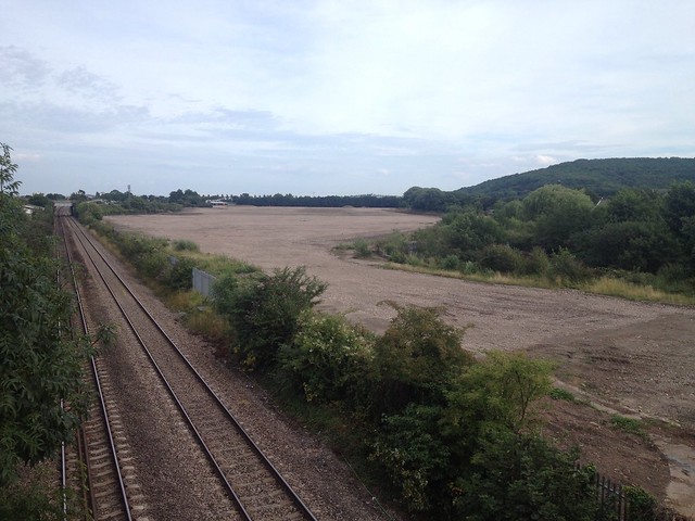
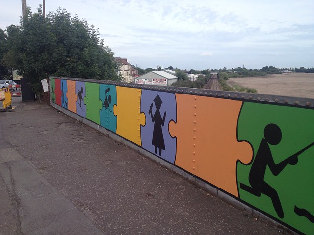
Looking at those photos it's certainly an area with great potential. Good links into town, the river to the south and Leckwith Woods as a backdrop. Not bad I'd say.
CARDIFFWALESMAP
- FORUM |